

List of districts of Arunachal Pradesh
List of districts of Arunachal Pradesh:- There are a total of 26 districts in Arunachal Pradesh. Shi Yomi and Lepa-Rada are the state’s newest districts, having been established in 2018. No additional district has been added to the state since then.
The administration of the Arunachal Pradesh district is the responsibility of an Indian Administrative Service Deputy Commissioner.
The state is being asked to create new districts. We have provided here the names of all of the districts that are currently in Arunachal Pradesh, information about the proposed districts, and the history of the state’s districts.
How Many Districts in Arunachal Pradesh
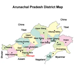
Arunachal Pradesh is made up of 26 districts. In 1972, Arunachal Pradesh was made a Union Territory, and on February 20, 1987, it was made a full-fledged Indian state. In the state of Arunachal Pradesh, there have been calls for the creation of new districts.
Arunachal Pradesh District List
We have provided the names of the districts in Arunachal Pradesh, as well as information about their year of formation, the area they cover, and their total population. The following provides information about the Arunachal Pradesh districts:
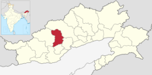
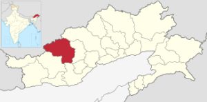
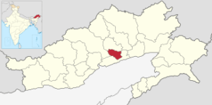
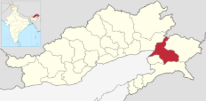
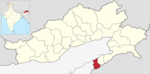
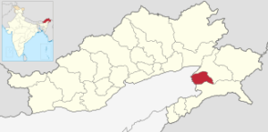
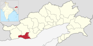
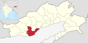
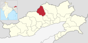
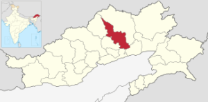
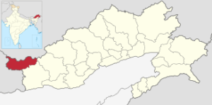
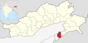
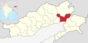
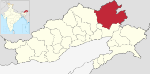
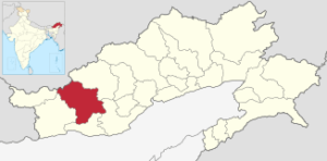
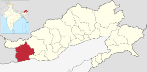
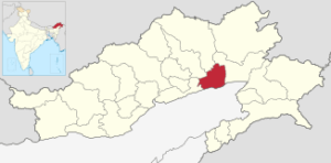
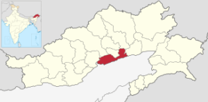
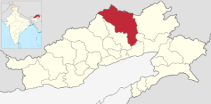
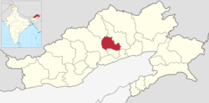
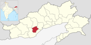
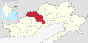
Map |
Headquarters |
District & Year created |
Population(2011) |
Density(/km2) |
Area(km2) |
|---|---|---|---|---|---|
|
|
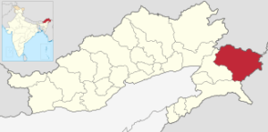
Hawai |
Anjaw (2004) |
21,089 |
3 |
6,190 |
|
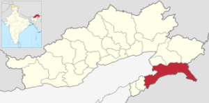
|
Changlang |
Changlang (1987) |
147,951 |
32 |
4,662 |
|
|
Raga |
Kamle (2017) |
22,256 |
111.28 |
200 |
|
|
Jamin |
Kra Daadi (2015) |
22,290 |
10 |
2,202 |
|
|
Koloriang |
Kurung Kumey (2001) |
89,717 |
10 |
8,818 |
|
|
Basar |
Lepa-Rada (2018) |
|||
|
|
Tezu |
Lohit (1980) |
145,538 |
61 |
2,402 |
|
|
Longding |
Longding (2012) |
60,000 |
50 |
1,200 |
|
|
Namsai |
Namsai (2014) |
95,950 |
60 |
1,587 |
|
|
Lemmi |
Pakke-Kessang (2018) |
|||
|
|
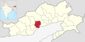
Yupia |
Papum Pare (1992) |
176,385 |
61 |
2,875 |
|
|
Tato |
Shi-Yomi (2018) |
13,310 |
4.6 |
2,875 |
|
|
Boleng |
Siang (2015) |
31,920 |
11 |
2,919 |
|
|
Tawang Town |
Tawang (1984) |
49,950 |
24 |
2,085 |
|
|
Khonsa |
Tirap (1965) |
111,975 |
47 |
2,362 |
|
|
Roing |
Lower Dibang Valley (2001) |
53,986 |
14 |
3,900 |
|
|
Anini |
Dibang Valley (2001) |
7,948 |
1 |
9,129 |
|
|
Seppa |
East Kameng (1980) |
78,413 |
19 |
4,134 |
|
|
Bomdila |
West Kameng (1980) |
87,013 |
12 |
7,422 |
|
|
Pasighat |
East Siang (1980) |
99,019 |
25 |
4,005 |
|
|
Likabali |
Lower Siang (2017) |
80,597 |
||
|
|
Yingkiong |
Upper Siang (1994) |
33,146 |
5 |
6,188 |
|
|
Aalo |
West Siang (1980) |
112,272 |
12 |
8,325 |
|
|
Ziro |
Lower Subansiri (1980) |
82,839 |
24 |
3,460 |
|
|
Daporijo |
Upper Subansiri (1980) |
83,205 |
12 |
7,032 |
Itanagar (2022) |
122,930 |
200 |
History of Arunachal Pradesh
In September 1965, the Ministry of Home Affairs assumed control of the North-East Frontier Agency, transforming its five divisions—Kameng, Subansiri, Siang, Lohit, and Tirap—into districts. From the initial five, numerous new districts were established over the following few years:
-
The Subansiri district was divided into two districts on May 13, 1980: Districts of Lower Subansiri and Upper Subansiri The former Daporijo sub-division was located in the Upper Subansiri district, while the remaining Subansiri district was located in the Lower Subansiri district.
-
On June 1, 1980,
- There were two districts in the former Lohit district: Districts of Lohit and Dibang Valley
- The district of Siang was divided into two districts: The districts of East Siang and West Siang.
- East Kameng district and West Kameng district were created from the Kameng district’s Seppa and Bomdila subdivisions, respectively.
-
East Kameng district and Tawang district were separated on October 6, 1984.
-
The former Tirap district was divided into two districts in 1987: The districts of Tirap and Changlang.
-
The former Lower Subansiri district was once again divided into Lower Subansiri district and Papum Pare district on September 22, 1992.
-
East Siang district and Upper Siang district were separated on November 23, 1994.
-
The Lower Subansiri district was split off from the Kurung Kumey district on April 1, 2001.
-
Dibang Valley district was divided into Lower Dibang Valley district and Dibang Valley district on December 16, 2001.
-
The former Lohit district was divided into the Anjaw district on February 16, 2004.
-
Longding district was created on March 19, 2012, from the former Tirap district.
-
On November 25, 2014, the former Lohit district was divided into the Namsai district and the Namsai district.
-
The Kurung Kumey district was split off from the Kra Daadi district on February 7, 2015.
-
A new Siang district was created on November 27, 2015, from portions of the East and West Siang districts.
-
West Siang and East Siang districts were divided into Lower Siang districts on September 22, 2017.
-
On December 4, 2017, Lower Subansiri District and Upper Subansiri District were combined to form a new district with the name Kamle district. The district’s headquarters will be in Raga. It consists of the Lower Subansiri District’s Kumporijo and Dollungmukh administrative circles, which will serve as the district HQ. Gepen Circle, Puchigeko Circle, and Daporijo Sadar—all of which fall under the 25 Raga Constituency and include Ligu and Liruk’s demarcation from the Sigen Subansiri confluence into a Single Administrative Unit—will be the administrative circles taken from Upper Subansiri District.
-
On August 30, 2018, the following three new districts were established:
-
Pakke-Kesang was carved out of East Kameng district and consists of five administrative units: Pakke-Kessang, Seijosa, Pijiriang, Passa Valley, and Dissingn Passo, with Lemmi serving as the district headquarters.
-
The Lower Siang district was divided into Lepa-Rada, with the headquarters at Basar and four administrative units of Tirbin, Basar, Daring, and Sago.
-
Shi-Yomi was formed by dividing the West Siang district into four parts. The district’s headquarters are in Tato, and Mechuka, Tato, Pidi, and Manigong are the four administrative units.
-
Proposal for New Arunachal Pradesh Districts
Arunachal Pradesh is considering creating new districts. The information regarding the proposed districts in Arunachal Pradesh has been made available here.
-
The current district of Papum Pare is being proposed to be divided into the Sagalee district.
-
In 2017, there was talk of splitting up the Changlang district to create a new Rima district.
-
The existing Arunachal Pradesh districts of Anjaw and Lohit should be combined to form a new district called Hayuliang.
-
From the three districts that are currently in existence—Kurung Kumey, Kra Daadi, and Upper Subansiri—people are calling for the creation of the North Subansiri district.
Short History of Districts of Arunachal Pradesh
The districts of Arunachal Pradesh have a fascinating history. We have provided information about the past of numerous Arunachal Pradesh districts here.
-
The Upper Siang district was formed on November 23, 1994.
-
The Kurung Kumey district was established in 2001, and the Dibang Valley district was split into Lower Dibang Valley and Dibang Valley.
-
On February 16, 2004, the Anjaw district was established.
-
Longding district was separated from Tirap district on March 19, 2012.
-
The Namsai district in Arunachal Pradesh was established on November 25, 2014.
-
The Siang and Kra Daadi districts were established in 2015.
-
Kamle and Lower Siang, two brand-new districts in Arunachal Pradesh, were established in 2017.
-
The three new districts of Shi Yomi, Lepa-Rada, and Pakke-Kesand were established on August 30, 2018.
Districts of Arunachal Pradesh FAQs
Q1. In the year 2023, how many districts will Arunachal Pradesh have?
Arunachal Pradesh has 26 districts as of 2023. Anjaw, Kra Daadi, Namsai, East Kameng, Lohit, Longding, Tawang, Siang, Itanagar, West Kameng, Papum Pare, Upper Subansiri, Lower Subansiri, Dibang Valley, and others are the names of the districts in Arunachal Pradesh.
Q2. Which of Arunachal Pradesh’s three largest districts are they?
Dibang Valley, Kurung Kumey, and Kurung Kumey are the three largest districts in Arunachal Pradesh in terms of area. The specifics of the region that these Arunachal Pradesh districts cover is provided here.
-
-
- 9,129 square kilometers make up the Dibang Valley.
- 8,818 square kilometers—Kurung Kumey.
- 8,325 square kilometers make up West Siang.
-
Q3. Which are the most recent districts in Arunachal Pradesh?
Shi Yomi and Lepa-Rada are Arunachal Pradesh’s most recent districts. In 2018, the state was expanded to include these two districts. No additional districts have been added to the state since then. Arunachal Pradesh, on the other hand, has a significant demand for the establishment of new districts.
Q4. Which of the new Arunachal Pradesh districts has been proposed?
There are several proposed districts in Arunachal Pradesh. The following are the proposed new Arunachal Pradesh districts.
-
-
Districts of Sagalee
-
Rima
-
North Subansiri
-
Hayuliang
-
Q5. Where can I find a list of Arunachal Pradesh’s districts?
The Chhatisgarh district list is available here. You can see the names and additional information for each of the 33 districts in Chhatisgarh. Find out specifics about each district’s total area, population, and more in Chhatisgarh.
Learn more about each state’s number of districts.
Indian States
| Arunachal Pradesh |
Assam |
Bihar |
Chhattisgarh |
| Delhi |
Goa |
Gujarat |
Haryana |
| Himachal Pradesh |
Jammu Kashmir |
Jharkhand |
Karnataka |
| Kerala |
Madhya Pradesh |
Maharashtra |
Manipur |
| Meghalaya |
Mizoram |
Nagaland |
Odisha |
| Punjab |
Rajasthan |
Seemandhra |
Sikkim |
| Tamilnadu |
Telangana |
Tripura |
Uttar Pradesh |
| Uttarakhand |
West Bengal |
Union Territories
| Andaman and Nicobar |
Chandigarh |
Dadra and Nagar Haveli |
| Daman and Diu |
Lakshadweep |
Puducherry |
———————————————————- The End —————————————————–
www.GKDuniya.in will update many more new jobs and study materials and exam updates, keep Visiting and share our post of Gkduniya.in, So more people will get this. This content and notes are not related to www.GKDuniya.in and if you have any objection over this post, content, links, and notes, you can mail us at gkduniyacomplaintbox@gmail.com And you can follow and subscribe to other social platforms. All social site links are in the subscribe tab and bottom of the page.
Important Links
Official Links ———————————————————- Related Links
You-tube ———————————————————- GKDuniya9
Instagram ———————————————————- GKDuniya.in
Facebook ———————————————————- GKDuniya.in
Twitter ———————————————————- GKDuniya.in
Linkedin ———————————————————- GKDuniya.in
Pinterest ———————————————————- GKDuniya.in
Google Rank ———————————————————- Gkduniya